
Short answer
Vietnamese riders call Ma Pi Leng, O Quy Ho, Pha Din and Khau Pha the “tứ đại đỉnh đèo”, the four great passes of the north.[1] It is a popular title, not an official one. O Quy Ho is the longest and highest, at nearly 50 km and about 2,000 m. Pha Din carried supplies to Dien Bien Phu in 1954, Ma Pi Leng hangs above the Nho Que river, and Khau Pha looks over the rice terraces of Mu Cang Chai. Our Northern Territory Loop rides the first three.
The four passes at a glance
4
great passes, by popular title
~2,000 m
O Quy Ho, the highest
~50 km
O Quy Ho, the longest
3
on our Northern Territory Loop
Since 1 July 2025, when Vietnam merged its provinces, Ma Pi Leng has been in Tuyen Quang province (which took in Ha Giang) and Khau Pha in Lao Cai (which took in Yen Bai). O Quy Ho links Lao Cai and Lai Chau, and Pha Din lies on the border of Son La and Dien Bien, two provinces that did not change.[2]
| Pass | Road | Province (since 2025) | Length | Height | On our tour |
|---|---|---|---|---|---|
| Ma Pi Leng | QL4C, Dong Van–Meo Vac | Tuyen Quang (formerly Ha Giang) | ~20 km | ~1,200–1,500 m | Day 7 |
| O Quy Ho | QL4D, Sa Pa–Tam Duong | Lao Cai and Lai Chau | ~50 km | ~2,000 m | Day 4 |
| Pha Din | QL6, Thuan Chau–Tuan Giao | Son La and Dien Bien | 26–32 km | 1,648 m | Day 3 |
| Khau Pha | QL32, Tu Le–Mu Cang Chai | Lao Cai (formerly Yen Bai) | ~30 km | 1,200 m+ | Not on the route |
QL = quốc lộ, national highway. Lengths and heights differ between sources; where they do, we give a range.
Ma Pi Leng: above the Nho Que river
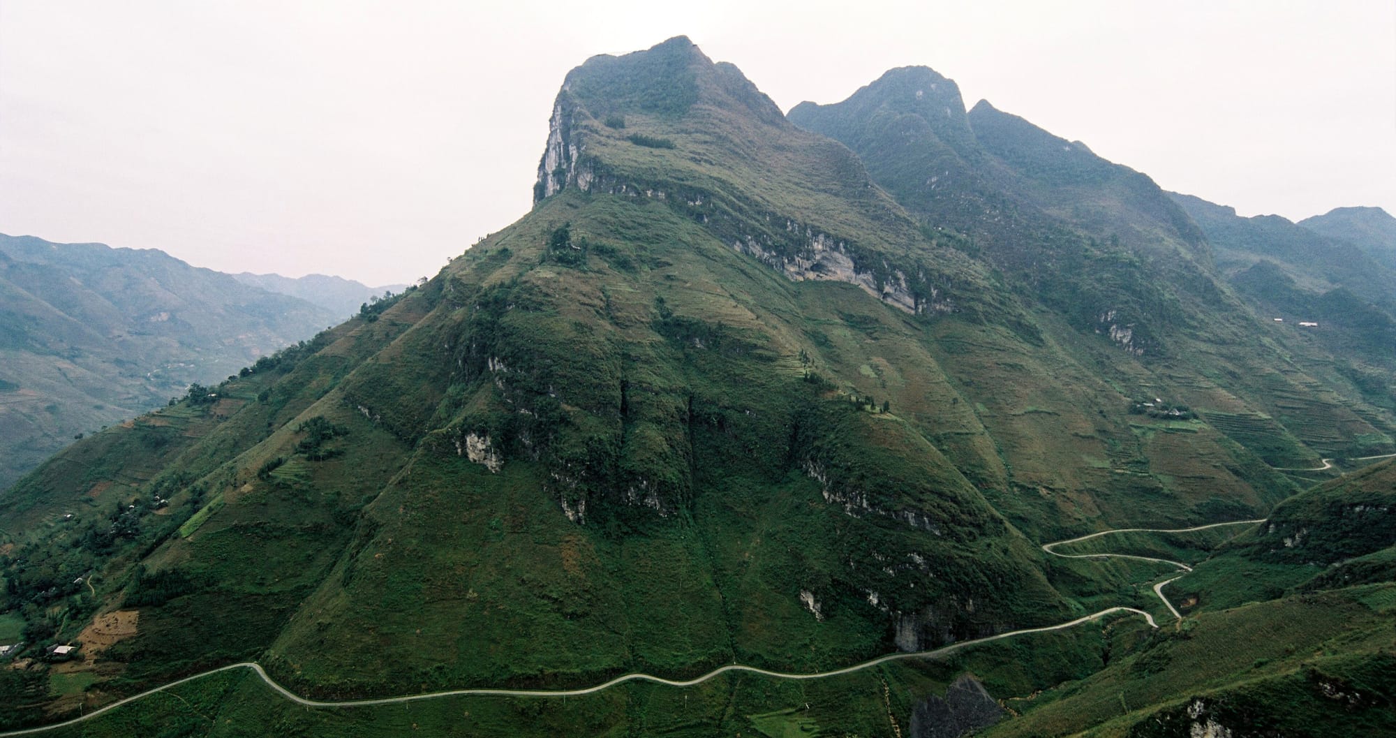
Ma Pi Leng is the stretch of National Highway 4C, the “Happiness Road”, between Dong Van and Meo Vac: about 20 km cut into the cliffs above the Nho Que river.[3] In Hmong the name means roughly “horse’s nose ridge”, after the shape of the ridge, and local Hmong also call the summit the “gate of heaven”.[3][4] Sources put the road at between about 1,200 and 1,500 m.[3][7]
Below the road, the Nho Que cuts the Tu San gorge.[3] The pass was ranked a national scenic site in 2009,[5] and it lies inside the Dong Van Karst Plateau, which UNESCO recognised in 2010 as Vietnam’s first Global Geopark.[6] The Happiness Road itself was built by hand between 1959 and 1965, and runs for more than 185 km.[6]
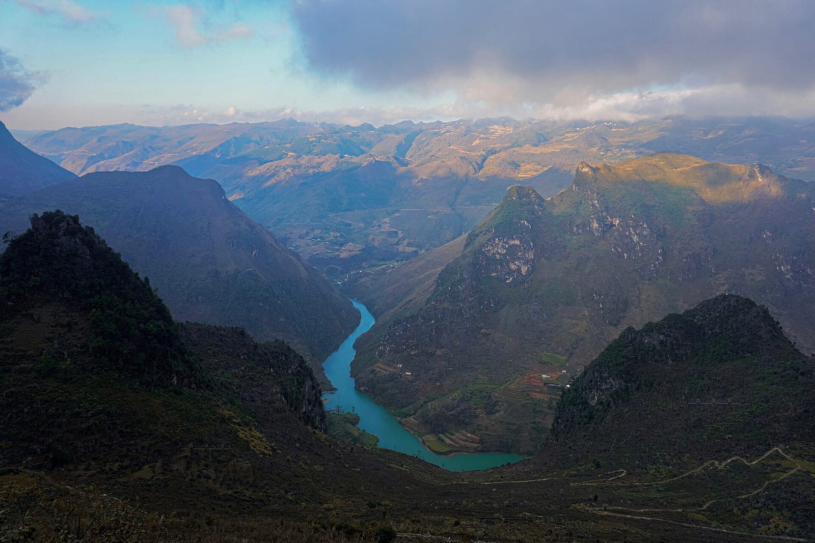
The Nho Que river, seen from Ma Pi Leng.
Photo: NKSTTSSHNVN, CC BY-SA 4.0, via Wikimedia Commons, resized.
Since 10 October 2026, the rock outcrop known as the “death rock”, a popular photo spot, has been fenced off because of cracks and landslide risk. It will reopen only when it is safe.[8]
On our tour
Day 7, the Dong Van loop: coffee overlooking the pass, lunch at Ma Pi Leng and the Nho Que river viewpoint.
O Quy Ho: the king of the passes
O Quy Ho carries National Highway 4D from Sa Pa in Lao Cai to Tam Duong in Lai Chau, over the Hoang Lien Son range; about two-thirds of it is on the Lai Chau side.[9] It is nearly 50 km long, often called the longest pass in Vietnam, and its summit is about 2,000 m.[9][10] It is also known as Hoang Lien Pass or Cloud Pass, and the Vietnamese press calls it the “king of the north-western passes”.[9][10]
The name comes from a legend: a daughter of the Jade Emperor fell in love with a woodcutter called O Quy Ho, was kept from him, and became a bird whose call sounds like “o quy ho”.[9][10]
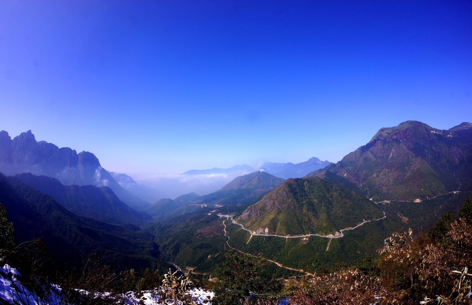
O Quy Ho from above in late December, with snow on the ground.
Photo: Kiếm Anh, CC BY-SA 4.0, via Wikimedia Commons, resized.
The two sides have different weather: the Sa Pa side is cold and often foggy in winter, while the Tam Duong side is warmer and drier.[10] In cold spells the summit can have frost and ice, and Lao Cai traffic police then ask drivers to slow down, keep a longer distance and avoid braking hard.[11] A road tunnel under the pass, the Hoang Lien tunnel (main tunnel 2.63 km), is planned; construction was due to start in December 2025.[12]
On our tour
Day 4, Dien Bien Phu → Sapa: coffee at the foot of the pass, then the viewpoint near the top before Sapa.
Pha Din: where sky meets earth
Pha Din carries National Highway 6 over the border between Son La and Dien Bien provinces.[13][15] Its highest point is 1,648 m.[1][13] The old road over the pass was 32 km long; the realigned road is about 26 km.[13] The name comes from the Thai language: “pha” means sky and “din” means earth, the place where sky and earth meet.[1]
In 1954 it was the main supply route to the Dien Bien Phu front. French aircraft patrolled and bombed it day and night, and it became known as the “bomb pocket”.[14] More than 8,000 youth volunteers worked to keep the road open.[13] In 2020 the Ministry of Culture, Sports and Tourism listed Pha Din Pass as a national historical site,[15] and a memorial temple to the fallen opened at the pass in 2024.[13]
Mornings can be foggy on parts of the pass; the fog usually clears by about 8:30 to 9:00.[1]
On our tour
Day 3, Ta Xua → Dien Bien Phu: we cross the pass between Son La and Tuan Giao, and end the day above the Dien Bien Phu battlefield.
Khau Pha: the horn of the sky
Khau Pha carries National Highway 32 between Tu Le and Mu Cang Chai, in what is now Lao Cai province (formerly Yen Bai).[18] Sources give lengths from 27 to 40 km, most often around 30 km, and heights of over 1,200 m.[16][17][18] In the Thai language the name means “horn of the sky”.[16]
The pass looks down on the rice terraces of Mu Cang Chai, a national scenic site since 2007.[16] Its top is a paragliding launch site, and each year in late September it hosts the “Flying over the golden season” festival.[17] The terraces turn gold in September and October, and are green in June and July.[17]
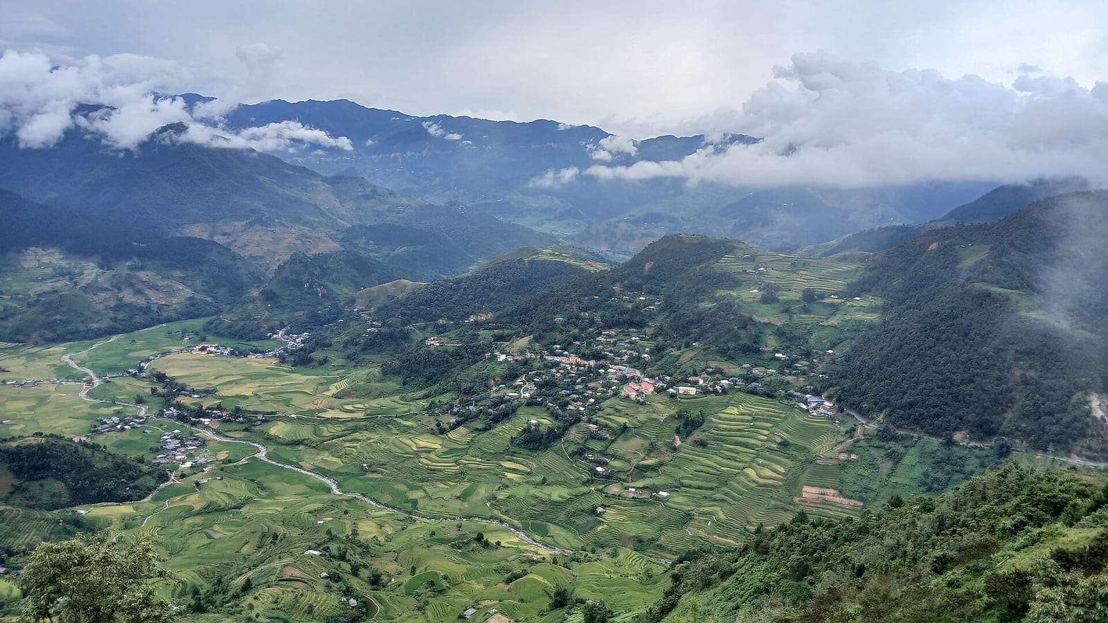
The valley below Khau Pha, Mu Cang Chai.
Photo: Victor311, CC BY 4.0, via Wikimedia Commons, resized.
The rainy season can close it: from 29 September 2025, landslides hit 30 to 40 places on the pass, and at km 269 about 30 m of road was swept away.[18]
On our tour
Khau Pha is not on our Northern Territory Loop. It lies further south-west, on the Nghia Lo–Mu Cang Chai–Than Uyen road. If you want to ride it, we can add it to a private custom ride.
Riding the passes with DME
Our Northern Territory Loop is an 11-day, 2,169 km guided ride from Ha Noi over Pha Din, O Quy Ho and Ma Pi Leng, and on to Ban Gioc waterfall. Every road is paved, and you ride with an English-speaking guide and a support team. Questions? Message us on WhatsApp.
Top photo: the road over Ma Pi Leng, by Khánh Hmoong, CC BY 2.0, via Wikimedia Commons, resized.
Sources
- [1]VnExpress. Đèo Pha Đin huyền ảo trong mây ngàn. 19 September 2014. vnexpress.net
- [2]Báo Chính phủ (Government of Vietnam news portal). Nghị quyết của Quốc hội về sắp xếp đơn vị hành chính cấp tỉnh. 12 June 2025. baochinhphu.vn
- [3]VnExpress. Vẻ đẹp đèo Mã Pì Lèng bên sông Nho Quế. 10 October 2019. vnexpress.net
- [4]VOV (Voice of Vietnam). Ấn tượng khi trải nghiệm đỉnh Mã Pì Lèng. 8 January 2018. vov.vn
- [5]Vietnam Nature and Biodiversity Conservation Agency. Ma Pi Leng Landscape Protection Area, Ha Giang. en.nbca.gov.vn
- [6]Báo Tuyên Quang. Đường Hạnh Phúc - di sản đặc biệt trên miền đá. 1 October 2025. baotuyenquang.com.vn
- [7]Vietnam National Authority of Tourism. The Ha Giang loop: a four-day road trip. vietnam.travel
- [8]VnExpress. Dựng rào chắn mới tại “mỏm đá tử thần” đèo Mã Pí Lèng. 13 October 2026. vnexpress.net
- [9]Lai Chau provincial tourism portal. Đèo Ô Quy Hồ. dulich.laichau.gov.vn
- [10]Nhân Dân. Trên đỉnh “vua đèo” Tây Bắc. 18 June 2016. nhandan.vn
- [11]Báo Lào Cai. Cảnh báo nguy hiểm khi tham gia giao thông ở vùng có băng giá và tuyết rơi. 12 January 2021. baolaocai.vn
- [12]Báo Lào Cai. Sắp khởi công hầm đường bộ Hoàng Liên qua đèo dài nhất Việt Nam - Ô Quy Hồ. 8 November 2025. baolaocai.vn
- [13]Báo Sơn La. Đèo Pha Đin - Cung đường huyền thoại. 30 April 2024. baosonla.vn
- [14]VOV (Voice of Vietnam). Đèo Pha Đin ngày ấy, bây giờ. 30 April 2024. vov.vn
- [15]Ministry of Culture, Sports and Tourism. Thêm 15 di tích được xếp hạng cấp quốc gia. 29 October 2020. bvhttdl.gov.vn
- [16]Nhân Dân. Mù Cang Chải, mùa lúa vàng. 12 October 2013. nhandan.vn
- [17]Nhân Dân (English edition). Experiencing a tour in the sky by paragliding over Khau Pha Mountain Pass. 29 December 2024. en.nhandan.vn
- [18]VnExpress. Đèo Khau Phạ sạt lở, khách hủy tour ngắm mùa vàng. 2 October 2025. vnexpress.net
Based on Vietnamese government sources and national and provincial newspapers. Lengths and heights differ between sources, and roads change with weather and roadworks; check conditions before you ride.
Last updated