
Short answer
The trail began in May 1959, when a secret unit called Group 559 opened a supply route from North to South Vietnam through the Truong Son mountains.[1] Vietnamese called it Route 559 or the Truong Son Road. The name “Ho Chi Minh Trail” came from the Americans, first in a 1961 report to President Kennedy, and became famous worldwide through a French-language book in 1971.[2][3]
Timeline: 1959 to today
January 1959
The 15th plenum of the Party Central Committee, chaired by Ho Chi Minh in Ha Noi, decides that the struggle in the South will combine political and armed action. The leadership resolves to open a strategic supply route through the Truong Son mountains.[1]
5 May 1959
Lieutenant General Nguyễn Văn Vịnh tasks Colonel Võ Bẩm with forming a “special military task group” to open the road and carry weapons, troops and documents between North and South.[1]
19 May 1959
On Ho Chi Minh’s birthday, the Central Military Commission formally gives the group its mission. The unit becomes Group 559, for May 1959, and 19 May is still celebrated as its founding day.[1][3]
Summer 1959
Battalion 301, the first Truong Son unit, sets out in secret from Khe Hó, west of Vinh Linh in Quang Tri. Its rule: walk without footprints, cook without smoke, talk without sound. It delivers its first load to the south on 13 August 1959.[1]
1961
With bombing on the eastern side, Group 559 moves the main route west of the mountains into Laos, with the agreement of the Lao People’s Revolutionary Party.[1]
1959–1963
Everything moves on backs, bicycles, horses and even elephants: 4,400 tonnes of weapons and more than 31,000 soldiers in the first four years.[1]
1964
On 17 June, Engineer Regiment 98 receives a flag reading “Open the road of unification”. On 9 August it digs the first stretch of motor road, from the Sê Pôn river to the Bạc river.[1]
1965–1975
Under heavy US air attack, the trail grows into a network of nearly 20,000 km, with 5 north-south axes and 21 cross routes. Nearly 4 million tonnes of bombs, shells and mines fall on Truong Son.[1]
1968–1973
A fuel pipeline is laid from Nam Đàn in Nghệ An all the way to Bù Gia Mập in Bình Phước: 1,400 km of pipe with 113 pumping stations.[1]
1971
The Route 9 – Southern Laos campaign, with nearly 40,000 South Vietnamese troops backed by 6,000 US troops and close to 1,000 aircraft, fails to cut the trail. In the dry season of 1971–72, crews build 3,000 km of road hidden under tree cover so trucks can drive by day.[1]
1973
After the Paris Agreement, the eastern Truong Son road is built from Tân Kỳ (Nghệ An) to Chơn Thành (Bình Phước), 1,200 km long.[1] The route is officially renamed the Ho Chi Minh Road.[2]
1975
Two truck divisions with more than 2,000 vehicles carry three army corps, over 100,000 troops, south to Saigon. General Võ Nguyên Giáp’s order of 7 April 1975 is relayed along the trail’s own communication lines.[1]
1975–1977
Truong Son National Cemetery is built on Bến Tắt hill in Gio Linh, Quang Tri, beside the road. It holds 10,263 graves.[5]
2000
Work starts on the modern Ho Chi Minh Highway, planned to run 3,183 km from Pác Bó in Cao Bằng to Đất Mũi in Cà Mau.[4]
9 December 2013
The Prime Minister lists the Truong Son Road – Ho Chi Minh Road as a special national monument: 37 sites in 11 provinces from Nghệ An to Bình Phước.[1]
How it got the name “Ho Chi Minh Trail”
What Vietnamese called it
Because the unit was Group 559, its secret route was called “Route 559” or the “559 liaison line”, and official Vietnamese documents later named it the Truong Son Road (Đường Trường Sơn).[3] Party histories describe it as an “avenue” rather than a trail, and soldiers and civilians called it “Ho Chi Minh Avenue”.[2]
1961: an American name
According to Vietnamese researcher Nguyễn Việt Phương, the name came from the Americans. In a 1961 report to President Kennedy, General Taylor called the route the “Ho Chi Minh trail”.[2][3]
The trail in numbers
16 years
of building and fighting, 1959–1975
~20,000 km
of roads, with 5 north-south axes and 21 cross routes
1,400 km
fuel pipeline with 113 pumping stations
~500 km
of river routes, by raft, boat and floating cargo
132,000 km²
area covered by the trail’s communication network
10,263
graves at Truong Son National Cemetery
All figures from the Department of Cultural Heritage, except the cemetery.[1][5]
Where to see it today
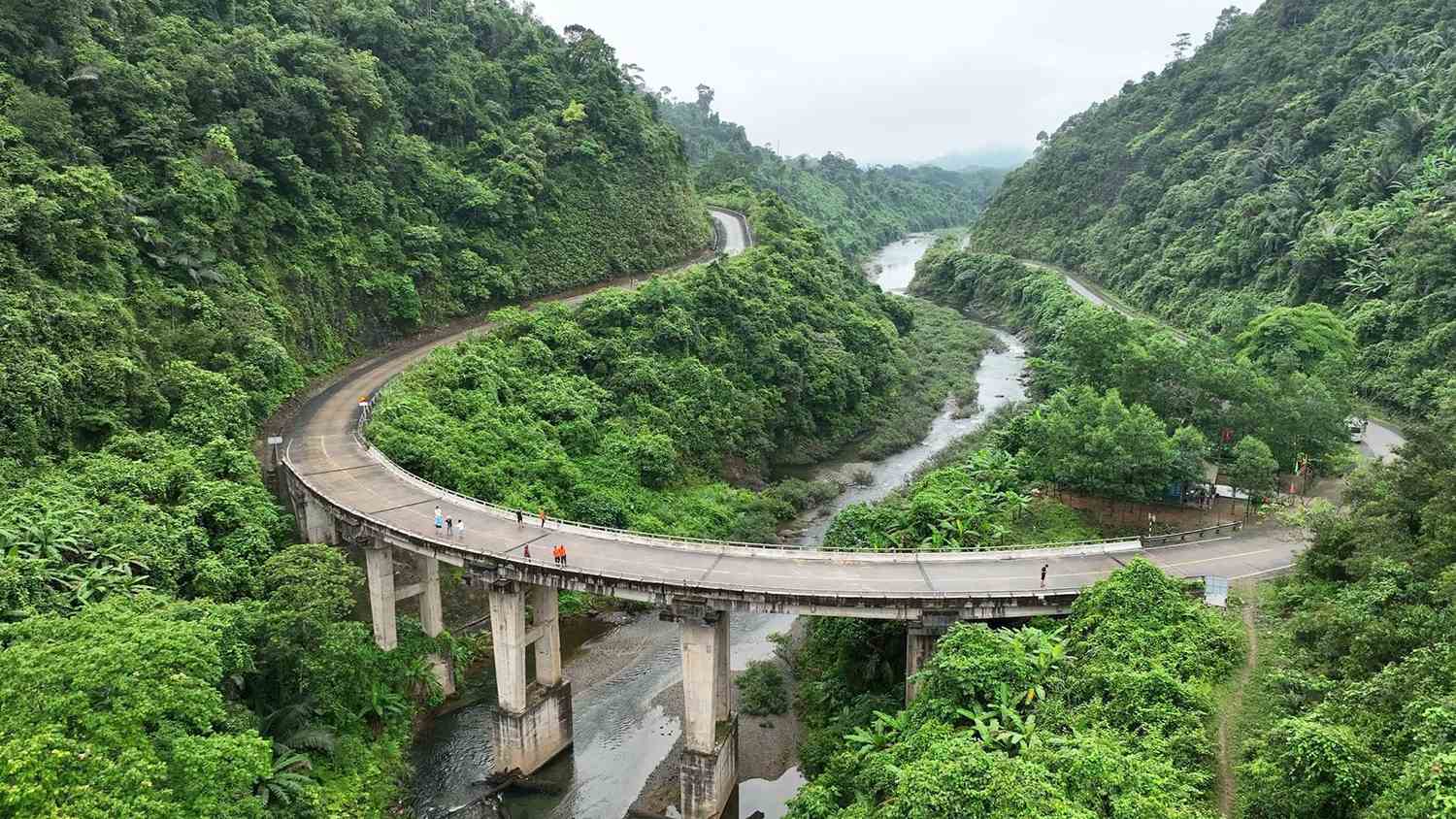
- 37 listed sites along the old route, including the Km0 marker at Tân Kỳ (Nghệ An), Đồng Lộc junction (Hà Tĩnh), the Road 20 Quyết Thắng caves (Quảng Bình), Khe Hó and the Đakrông bridge (Quảng Trị), and Dốc Con Mèo in A Lưới.[1]
- Truong Son National Cemetery on Bến Tắt hill, Gio Linh, beside the Ho Chi Minh Road.[5]
- The Ho Chi Minh Road: the modern highway makes the main sites easy to reach.[1][4]
Riding with DME
Our Truong Son War Trail rides from Ho Chi Minh City to Ha Noi through Khe Sanh and Phong Nha, in the provinces where much of this history happened. Ask us on WhatsApp about adding stops at trail sites along the way.
Sources
- [1]Department of Cultural Heritage, Ministry of Culture, Sports and Tourism. Di tích lịch sử Đường Trường Sơn - Đường Hồ Chí Minh (Historic site: the Truong Son Road - Ho Chi Minh Road). dsvh.gov.vn
- [2]Sài Gòn Giải Phóng newspaper. Tại sao lại gọi là “Đường mòn Hồ Chí Minh”? (Why is it called the “Ho Chi Minh Trail”?). 14 May 2005. www.sggp.org.vn
- [3]Người Lao Động newspaper (via Tuổi Trẻ). Van Geirt - Người gọi tên “Đường mòn Hồ Chí Minh” (Van Geirt, the man who named the “Ho Chi Minh Trail”). 20 May 2009. tuoitre.vn
- [4]Voice of Vietnam (VOV). Nối thông đường Hồ Chí Minh từ Pác Bó đến Mũi Cà Mau năm 2025 (Connecting the Ho Chi Minh Road from Pac Bo to Ca Mau Cape by 2025). 15 December 2024. vov.gov.vn
- [5]Ha Noi legal information portal. Nghĩa trang Trường Sơn – nơi yên nghỉ của các anh hùng liệt sĩ (Truong Son Cemetery). 22 December 2022. pbgdpl.hanoi.gov.vn
This page is based on the Vietnamese government’s official heritage record and Vietnamese national news media. Accounts of the name’s origin come from Vietnamese researchers as reported in the press.
Last updated