
Short answer
From 1954 to 1975 Vietnam was divided at the 17th parallel, along the Ben Hai river in Quang Tri, with Hien Luong Bridge as the crossing point.[1] In the hills of western Quang Tri, the battle of Khe Sanh began on 20 January 1968 and lasted more than 170 days, ending with US forces leaving the base in July 1968.[4][5]
The DMZ: Vietnam divided at the 17th parallel
20 July 1954
The Geneva Agreement temporarily divides Vietnam into North and South at the 17th parallel, along the Ben Hai river, until nationwide elections planned for July 1956.[1]
1954–1967
Hien Luong Bridge becomes the symbol of the divided country. A joint North–South commission meets beside it under the watch of International Team 76.[1]
1956
The elections never take place. It will be 21 years, until 1975, before the country is reunified.[1]
1965–1972
Vinh Linh, the North’s frontline district just above the river, is bombed with hundreds of thousands of tonnes of bombs. In 1966–1968 its people dig 114 tunnels totalling more than 40 km to live, farm and fight underground.[2]
1967
US bombs destroy Hien Luong Bridge.[1]
1975
The war ends and the country is reunified.[1]
2001–2008
Hien Luong Bridge is rebuilt to its original 1952 French design: 183.65 m long and 5.5 m wide.[1]
9 December 2013
The two banks of Hien Luong – Ben Hai are listed as a special national monument.[1]
Vinh Moc: a village underground
To survive the bombing north of the line, the people of Vinh Linh lived underground. Vinh Moc is the best known of their tunnels, and you can walk through it today.[2]
1,701 m
of tunnels
10–23 m
below ground
3 levels
homes, command post, stores
13
entrances, 7 facing the sea
Families lived in small rooms cut every 3–5 m along the main 768 m passage, with a meeting hall for 50 people, kitchens, wells, toilets and a nursery. The deepest level stored supplies for Cồn Cỏ island and the southern front.[2]
The battle of Khe Sanh, 1968
In Vietnamese history it is the Route 9 – Khe Sanh campaign, a strategic feint to draw US forces away from the cities before the Tet Offensive. The US hoped to turn Khe Sanh into a “reverse Điện Biên Phủ”.[4]
1966–1968
Ta Con airbase is a US strategic base and a key link in the Khe Sanh base complex, 3 km north of Khe Sanh town.[3]
6 December 1967
Vietnam’s Central Military Commission sets up the command of the Route 9 – Khe Sanh campaign, led by Major General Trần Quý Hai.[4]
20 January 1968
The campaign opens at night, ten days before the Tet Offensive. By 7 February, attacks on Huong Hoa district town, Huội San and Làng Vây give control of Route 9 from Cà Tu to the Laos border.[4]
10 Feb – 31 Mar 1968
Ta Con is encircled for 50 days and nights. The US commits the 1st Air Cavalry Division, the 3rd Marine Division and massive air and artillery support.[4]
April – July 1968
Fighting continues around Làng Khoai, Cu Bốc and Hills 689 and 622, then a final push from 8 May to keep pressure on Ta Con as US forces withdraw from Khe Sanh.[4]
9 July 1968
Khe Sanh and all of Huong Hoa district are liberated, a date still marked every year in Khe Sanh.[5]
15 July 1968
After more than 170 days, the campaign formally ends.[4]
The outcome, in Vietnamese records
Nearly 12,000 enemy troops, mostly American, put out of action; part of the Route 9 defence line broken; and Huong Hoa district, with almost 10,000 people, liberated.[4]
Khe Sanh in photos, 1967–1968
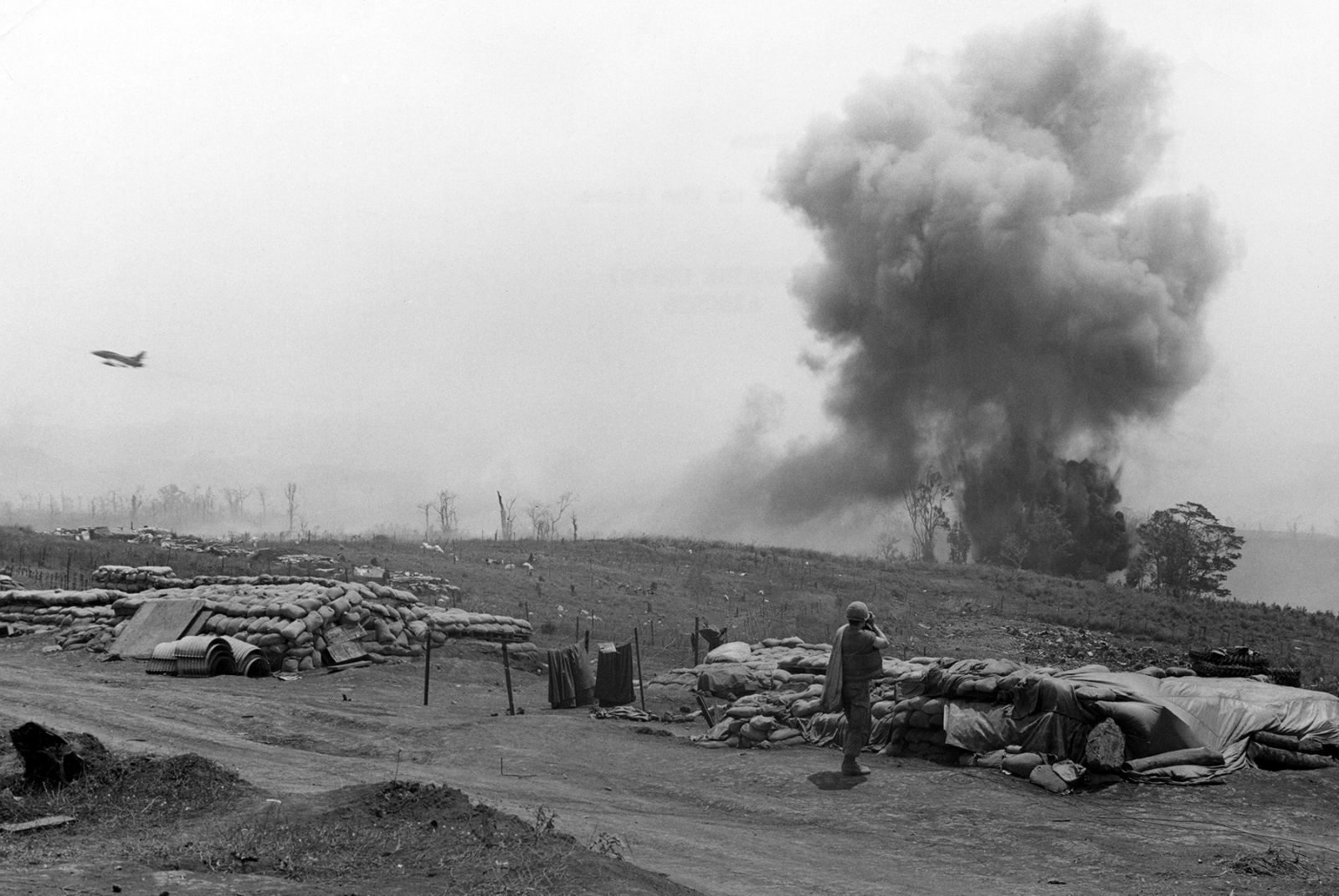
Photographs taken by US military photographers at Khe Sanh Combat Base. They are US government works in the public domain. The photo at the top of this page shows a US Air Force F-100 dropping bombs close to the base on 15 March 1968 (official US Marine Corps photo A190936).
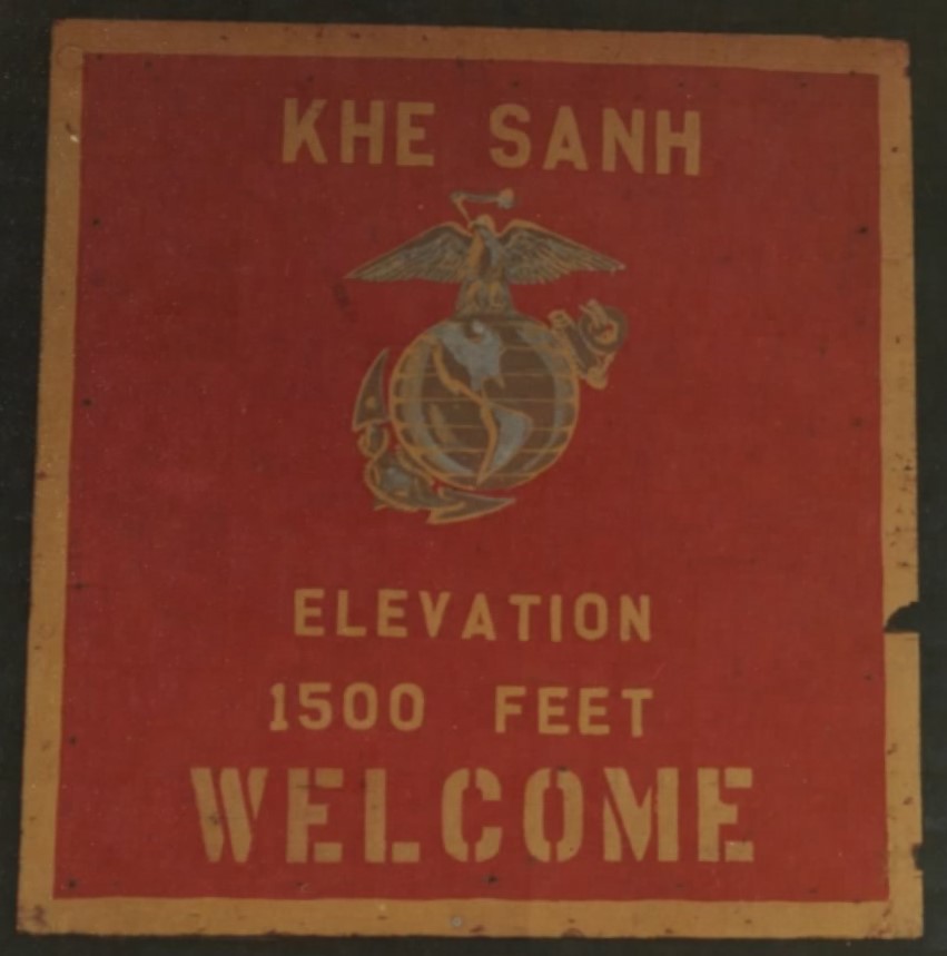
“Khe Sanh – Elevation 1500 feet – Welcome”: a sign at Khe Sanh Combat Base, 19 November 1967.
Photo: US National Archives (NARA 127-GVC-114-A193235A), public domain, via Wikimedia Commons.
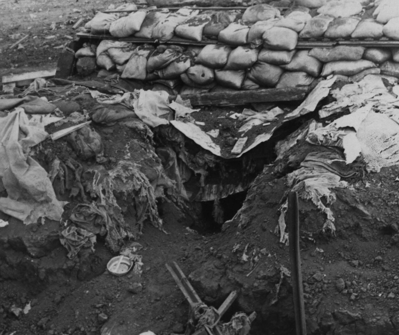
A bunker at Khe Sanh after a direct rocket hit, 22 January 1968, two days into the siege.
Photo: Official US Marine Corps photo, National Archives 26389687, public domain, via Wikimedia Commons.
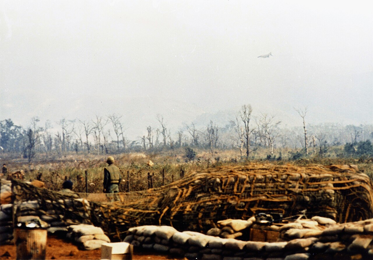
Marines watch a US Air Force F-4 Phantom make a close air support strike near the base, March 1968.
Photo: Sgt. Robert F. Witowski, US Air Force, public domain, via Wikimedia Commons.
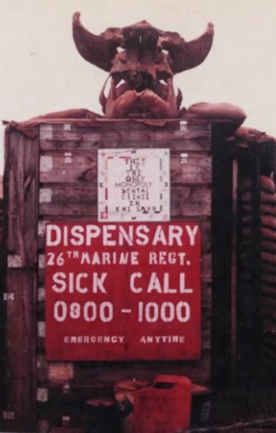
The 26th Marine Regiment dispensary sign: sick call 0800–1000, emergencies any time. 21 February 1968.
Photo: Cpl. L. F. George, US Marine Corps (NARA 127-GVC-114-A190601), public domain, via Wikimedia Commons.
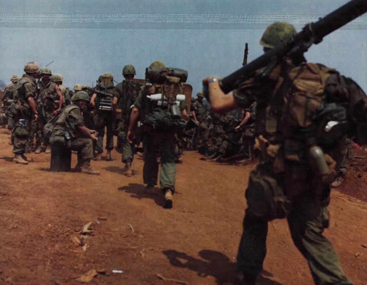
A 1st Cavalry soldier watches Marines leave Khe Sanh Combat Base after the relief operation, 6 April 1968.
Photo: SSG Luis Dacurro, US Army (NARA 111-CCV-389-CC47919), public domain, via Wikimedia Commons.
What to see today
- Hien Luong Bridge and the Ben Hai river on Highway 1A: the rebuilt bridge, the 28 m flag tower on the north bank, the loudspeaker towers, the joint commission house, the exhibition “The 17th Parallel and the Wish for Unification” and the reunification monument on the south bank.[1] A reunification festival is held here every 30 April.[1]
- Vinh Moc tunnels in Vinh Linh, on the coast north of the river.[2]
- Ta Con airbase, 3 km north of Khe Sanh town and about 400 m from the Truong Son road: a national monument since 1986, with aircraft and wartime relics on display. Open 7 am to 6 pm.[3]
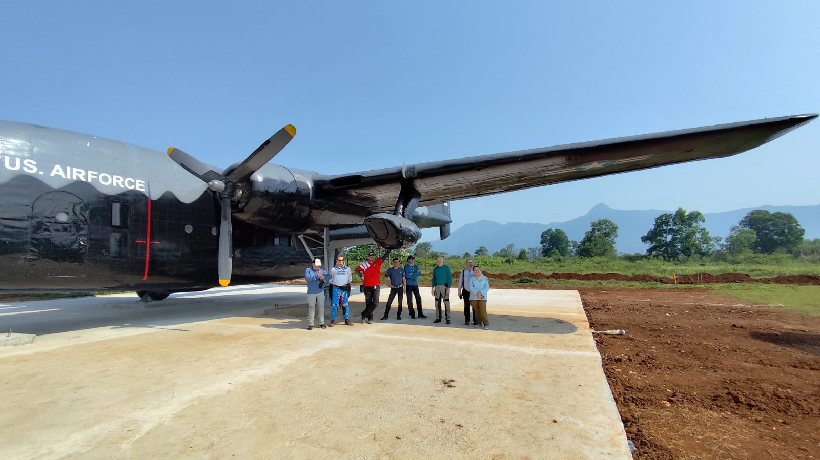
DME riders under the wing of a US Air Force transport plane on display at Ta Con.
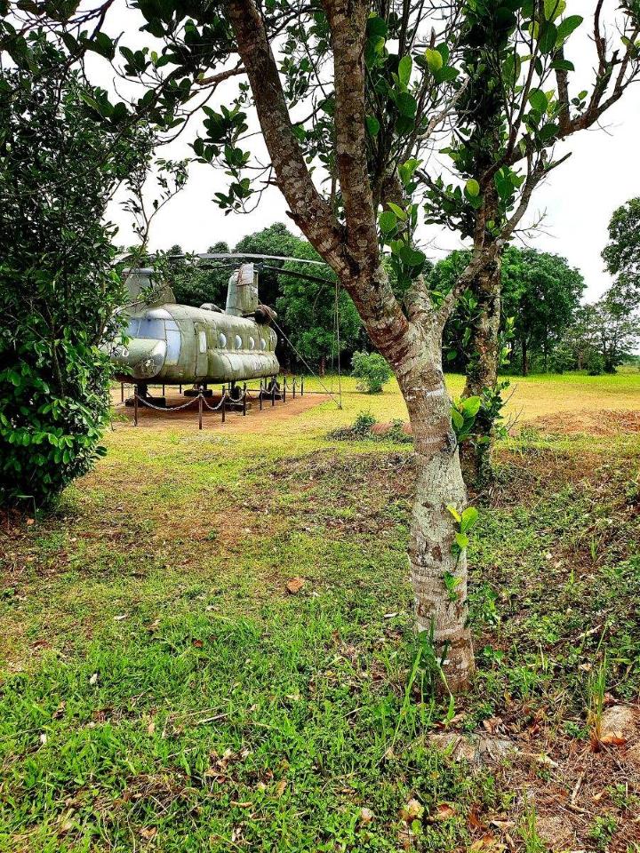
A CH-47 Chinook on display at the Ta Con relic site, May 2023.
Photo: Phương Huy, CC0, via Wikimedia Commons, resized.
Riding with DME
Our Truong Son War Trail spends a night in Khe Sanh before riding north to Phong Nha. For the full story of the supply route these battles were fought over, read the history of the Ho Chi Minh Trail. Want to add Hien Luong or Vinh Moc to your ride? Ask us on WhatsApp.
Sources
- [1]Department of Cultural Heritage, Ministry of Culture, Sports and Tourism. Di tích lịch sử Đôi bờ Hiền Lương - Bến Hải (Historic site: the two banks of Hien Luong - Ben Hai). dsvh.gov.vn
- [2]Quang Tri Department of Culture, Sports and Tourism. Địa đạo Vịnh Mốc và hệ thống làng hầm Vĩnh Linh (The Vinh Moc tunnels and the tunnel villages of Vinh Linh). 27 September 2023. svhttdl.quangtri.gov.vn
- [3]Quang Tri tourism portal (Department of Culture, Sports and Tourism). Sân bay Tà Cơn (Ta Con airbase). dulich.quangtri.gov.vn
- [4]Quân đội Nhân dân, newspaper of the Ministry of National Defence. Chiến dịch Đường 9 - Khe Sanh: Đòn nghi binh chiến lược (The Route 9 - Khe Sanh campaign: a strategic feint). 7 December 2024. www.qdnd.vn
- [5]Quân đội Nhân dân, newspaper of the Ministry of National Defence. Kỷ niệm 55 năm Ngày Chiến thắng Khe Sanh - Giải phóng Hướng Hóa (55 years since the Khe Sanh victory). 7 July 2023. www.qdnd.vn
This page is based on Vietnam’s official heritage records, the Quang Tri provincial government and the Ministry of National Defence newspaper, so it tells the history from the Vietnamese record. Opening hours can change; check before you visit.
Last updated